Showing posts with label Rachel Carson Challenge. Show all posts

Sunday, June 20, 2010

Rachel Carson Challenge 2010

Saturday was the 2010 Rachel Carson Challenge (notes from previous Rachel Carson Challenges are here). My partner in crime this time was SS, who decided this past winter when things were rather boring that she needed a hobby, and this need of a hobby led her to the Rachel Carson challenge. As usual, we did the series of training hikes (Hi Donna! Hi Bob!) that included wet days and hot days. (I missed the really hot sunny day, figures)

Rachel Carson 2010 Challenge registration

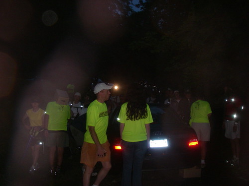
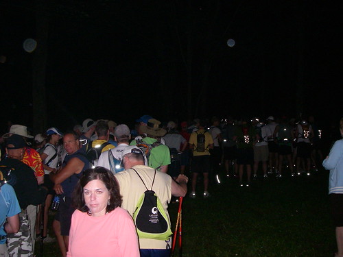
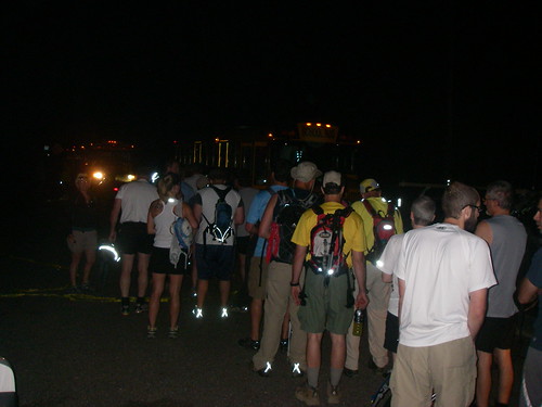
The challenge began with waking up at ~3 AM in the morning so we could catch the bus to Harrison Hills Park. And we did with time to spare before sunrise.

Waiting in the pre-dawn morning for the start for the 2010 Rachel Carson Challenge

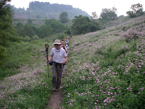
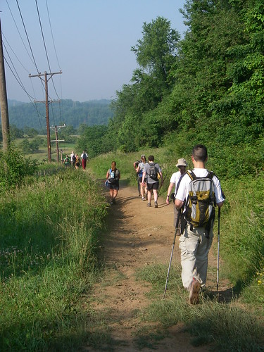
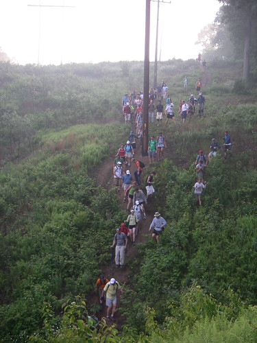
We raced through the first section, keenly aware that we wanted to cover miles before it got sunny. By the first checkpoint, everything was still sunny and good.

Checkpoint one -  still in good shape

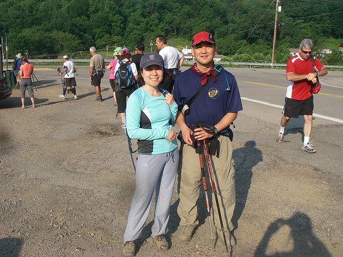
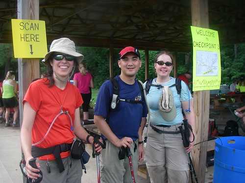
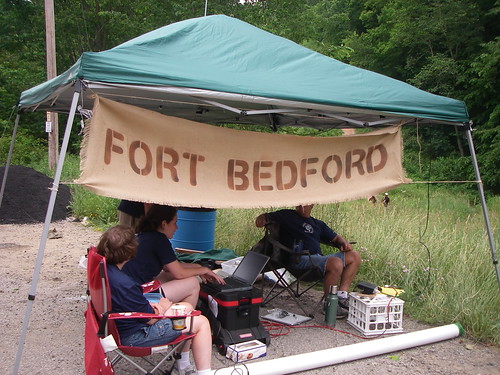
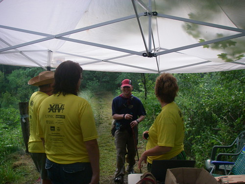
By the second checkpoint I was running into trouble. I had run out of water along the way, and the second checkpoint had run out of gatorade. (and forgotten my extra bottles of water in the kitchen on the way out the door) So by checkpoint 3 I was starting to dehydrate. Checkpoint 3 was a definite rehydration stop. I filled up my camelbak with gatorade with the goal of finishing it before I left while I was essentially eating lunch. In addition to the usual PB&J sandwiches, oranges, bananas, pretzels and chips there were salted potatoes. But I realized that I was not going to speed up anytime soon so SS found a group and went on ahead. I started from Checkpoint 3 and things got better for me as electrolytes were absorbed into my body.

The auto junkyard along the Rachel Carson trail

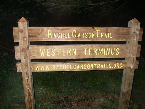
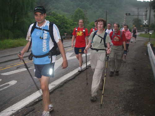
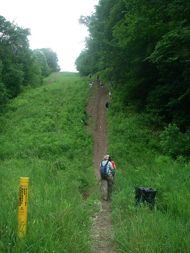
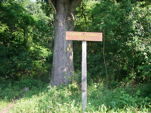
The Rachel Carson Trail is a connector trail. It connects a number of county and municipal parks in Allegheny County, starting in Harrison Hills Park and going through Agan Park, Emmerling Park, Hampton Community Park, and ending in North Park. (MapMyHike link). Allegheny County is an urban county (includes Pittsburgh, PA) so to connect all these parks means that there is substantial private property and hiking along roads along the way. There are numerous hills (i.e. too steep for building roads or houses) and streams without bridges on the trail.

By checkpoint four, I was feeling pretty good. And I had four hours to go the last 8.2 miles. No problem. But the clouds were rolling in. And about an hour after I left checkpoint four it started raining. And heavily. And thunder. I found a group that was working through Hampton Community Park together and we made it across Route 8 together. Then the trail started to follow Pine Creek. And by follow I mean we had to cross it. Five times.

Raging streams after a thunderstorm

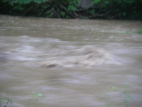
The creek in the areas we had to cross it ranged from 20 to 30 feet across. While normally it is a shallow gravel stream bed with water about an inch above the gravel, that day after the thunderstorm it was a raging stream thigh deep. I hooked up with J and J from our little group and we crossed the streams together, holding arms to keep each other from being knocked down and dragged by the current.


After this major adventure, we reached North Park. There were four relatively easy stream crossing (much higher than normal, but by this point they were easy), and then the trail went up and into the park proper. A couple miles here and on to one last stream crossing and to the finish at Beaver Shelter.

Finishing with a run

Why do something like this? Like a t-shirt says, it is called the Rachel Carson Challenge, not the Rachel Carson Walk. It is a challenge. And like anything worthy of the name, it is hard. I tend not to be a competitive person by nature, but I am drawn to things that are hard.

J, J and I at the finish

There is also the inherent honesty and reality to such things. You are dealing with nature in a raw and unforgiving form. Heat, sun, dehydration, nutrition, physical limits, water, streams, hills are real. There is no recourse to decisions made by authority that is granted by God or Man. There are people who believe that perception is reality. And on a trail such as this, even in the urban area of Pittsburgh, that is wrong. Perception is not reality and believing otherwise can get you killed. Reality is reality, and there are enough people who believe otherwise that a challenge like this with people who recognize this is a wonderful experience.

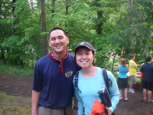
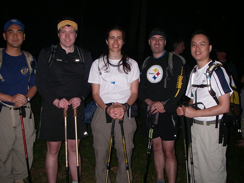
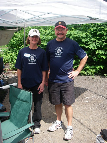
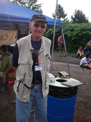
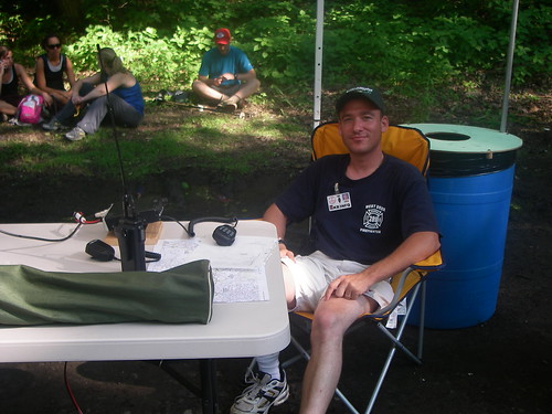
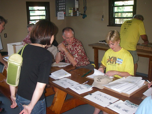
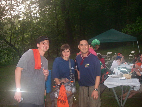
Many thanks to SS, for being a wonderful training and hiking companion. Donna, Bob, Mark and many other volunteers for your work (including washing everything today [Sunday]) J, J, E and KB3OGS for being companions along the way. And looking forward to the next challenge. As a volunteer.

SS and I at the finish

Wednesday, June 24, 2009

Rachel Carson Challenge 2009

This marked the third time I've hiked (not run) the Rachel Carson Challenge. The previous two times were in 2006 and 2008. (I was here in 2007). And of course, this time I aimed to finish on time. The past two times I was coming in right at the time limit at a full run (or I was trying to go at a full run, I was usually with people who got tired faster.

As usual, there was another task being accomplished. Last time, I was trying listen in on a 2M amateur radio (which I could do.) This time, I was running another experiment. I carried a GPS tracker that was connected to a 2M (VHF) transmitter that would broadcast my location on APRS. If all went well, it would be recorded by a digipeater that would record my position and track. All of this using equipment loaned by members of the Pitt Amateur Radio Club.

APRS setup

APRS setup

We began in North Park, going east. So it meant the fast part was at the beginning.

Start sign of the rachel carson

We waited in the dark, punctuated by reflective piping on everyone's shoes and gear, and the flourescent green shirts of the volunteers running the challenge.

Waiting before the challenge

I started out with a group that was part of an exercise club at Pitt, including a couple people from my department. We started out by crossing the stream at the beginning, helped by Mark E. the lead of the trail maintainers. Of course, B. went for a spill, filling the need to get muddy out of the way for the rest.

Moving on out

And it was important not to be concerned about getting muddy, because the trails were very muddy, a remnant of the heavy rains that caused major flooding in Turtle Creek, Pitcairn and Forest Hills earlier in the week (and yours truly was doing damage assessment for the Red Cross.) This slowed down progress through North Park to Route 8 significantly, as the mud sucked on our shoes as we went through.

Rachel Carson photographer at Route 8

Halfway through I met up with S and J, who I trained with for the 2008 Challenge, both of whom had traveled back to Pittsburgh for this.

Three of us at checkpoint 3

As usual, there were the many hills to climb and descend, with the twist that I was going in the opposite direction then I had in the past.

Climbing up

And then we pushed to the end. The clouds that were forecast throughout the day were over the finish at Harrison Hills Park, and as two of us raced through Harrison Hills Park (and made one wrong turn, that I figured out) the rains hit. Just as we got to the Bobwhite shelter, which USED to be the finish point. We pushed through the uphill through last part of the course through a downpour, which turned the trail into a torrent of muddy water. And when we got to the end, we emerged out of the woods to wild cheers of volunteers and other late finishers, who probably were not expecting anyone to navigate their way through the now skies after the setting sun and downpour.

Shoes after the Rachel Carson Challenge

And we were soaking wet, from shoes that were completely inundated with mud pressed in by the current, to clothes that were completely soaked. D, one of the volunteers, gave me a hug, and the water being squeezed out of my clothes was very visible. We wolfed down some burgers, I got a massage and a ride back home that evening.

And the experiment, well, it did not really work. But we knew this would be a problem because of the hills and valleys blocking the radio signal from the digipeater, and all the forest cover that blocks GPS signals. But we have some ideas for the second time we send someone with an APRS transmitter down the trail. All we need to do is find someone crazy enough to do the Rachel Carson Challenge while carrying a radio and GPS tracker . . .

APRS points taken during Rachel Carson challenge

Sunday, June 22, 2008

Rachel Carson Challenge 2008

Rachel Carson trail sign
Every year, the Rachel Carson Trails Conservancy puts on the Rachel Carson Challenge ("The Challenge), ~34 mile hike from Harrison Hills Park to North Park, along whatever trail the conservancy has been able to stitch together with a myriad of agreements with private landowners, from Sunrise to Sunset on the Saturday closest to the Summer Solstice. In a world that is used to thinking in terms of digital precision, there is something gratifying about an event whose time and dimensions are based on physical reality instead of arbitrary human will. But there is nothing comforting about The Challenge itself. In fact it is brutal. By the time you are done you feel someone massaged your legs with a baseball bat. And it is deep pain, deep into the muscles of the thighs and calves.

Quote:
Mary Reed in her article at getoutzine.com says from her experience in the challenge last year

I ask my fellow participants why they are doing this. The answers fall into three general categories: for the challenge; because I’m crazy and/or stupid; I was drunk when I signed up.

I got to the North Hills parking area where I was ushered in by Mark, whom I know as a Red Cross volunteer. I made my way to the start with two people who I met on one of the training hikes. One of them was dressed in colonial era dress, reflecting this year's theme of General Forbes march across Pennsylvania, along with Pittsburgh's 250th anniversary.

Quote:
When we told some Revoluntionary reenactors what we were doing (34 miles, one day), they said that if a horse did that we would have to put it down.

Colonial reenactor

We got to the start area and waited for sunrise. I met Steve there, setting up the tag scanning and radio. He remembered me from a computer donation a year ago.

My friends arrived soon after, and we waited for the beginning of the challenge along with the gathering crowd.

Five of us

Start area for the challenge


Quote:
M to me: "Oh, then you are normal"
T: "No, his fiancee would describe him as anything but normal"


The challenge itself began with the sunrise, with the moon still lit. In Harrison Hills park we were soon greeted by mist over a pond.

Misty pond with moon in Harrison Hills Park

And so it was, 34 miles of trails, some roads, fields of wildflowers to cross,

wildflowers on the trail

utility lines to follow,

IMGP0032

hills to descend,

Going down hills in the Rachel Carson Challenge

which always seemed to be followed by hills to climb.

The hills of Allegheny county

And along the way were the checkpoints, where volunteers checked us in, fed us, and encouraged us.

Volunteers at checkpoint 2

This year, also in keeping with the Pittsburgh 250th, the checkpoints also had names, after colonial era forts, like Fort Bedford.

Welcome to Fort Bedford

Along the way we had many random conversations. Encouraging other hikers, joking around with how crazy this was. Untangling just who recruited or hoodwinked, whom to do The Challenge. And giving aid, carrying packs of people who just could not get further and needed to get somewhere to be picked up. Wrapping knees or treating blisters. Giving directions and advice. Encouraging people to push further, letting those who could not go further know just how well they did. And talking about life, of service in Iraq and Afghanistan, a WWII vet who gave out water, the neighbor on the trail who gave out water, talking about married life and kids (letting a soon-to-be-married type some hints on what is to come).

I'm a believer that when I go hiking, I am usually doing something else as well, be it photography, birding, cooking and eating, or socializing. Of course, The Challenge is big enough that it can certainly be its own reason. But I used this as a test to my ability to carry radio equipment to last through the day. The Challenge has ham radio support at all the checkpoints and accompanying key volunteer staff throughout the day, some of whom are recruited off of the Allegheny County Public Service Net/ARES/RACES, which I am a part. So I carried a handheld radio, several batteries, and listened in throughout the day.

Ham at checkpoint one

As the day went on, the many things that go on were discussed over the radio net set up for The Challenge. From setting up the checkpoints, ensuring porta-potties were at all locations, to checking on supplies of food, water and ice. All the things that those of us on events are so thankful to see when we get to the checkpoints.

Radio at checkpoint 4

And the not so welcome messages. The tag numbers of the people dropping out. The questions about hikers not accounted for. Arranging for pickups of those who need help. And the warnings of the thunderstorm that was coming that evening.

As the miles went on and the knees were battered, I heard the warning coming of the thunderstorms for Ohio over the radio net, and that gave a sense of urgency to the last few miles. And on the trails of North Park the lightening and thunder started. My little group realized we were less than a mile from the finish, but took the better part of valor and jumped trail to the Sharon shelter to call for pickup. Not long after, we saw the sweep hikers shepherding other hikers off the trail and they brought us to the finish at Beaver shelter for food and rest for our battered legs.

Many thinks to all the volunteers, the training hike leaders (hi Bob and Donna), trail maintainers (hi Mark), everyone who manned checkpoints, logistics and management (hi Steve). And thanks to the radio support, for passing on their frequencies and letting me listen in, giving a bit of an education on the running of a net during an event. And for all the company on The Challenge. I'd welcome seeing you again on trails anywhere, anytime.

Monday, June 16, 2008

Gearing up for the Rachel Carson

Well, the Rachel Carson Challenge is this Saturday. Some things are not resolved just yet, like who will I be hiking with and when we are starting out, but there are options out there. But I'm a firm believer in I don't hike just for the sake of covering ground, I am always doing something else along the way. And that affects what I bring along.

Let's see, I am definitely bringing my VHF/UHF Handheld radio with me. I have a Yaesu FT-60R 2M/70cm radio. There are a few people on the Allegheny ARES/RACES who are assisting the Rachel Carson Trails Conservancy with radio support (whose members are busy obtaining their own licenses because this is so useful). So they will also let me know their frequencies, and I will be testing my ability to operate all day on foot, through forest and valley. I'm taking two extra batteries and I'm using a 1/4 wave antenna for the 2M band (Smiley 270A) I used a smaller MFJ-1717S on the practice hike, so I'll see if there is a difference. I've figured out my earpiece does not work so well on the move, so I'll use a handheld speaker mic. I'm using a Camelbak Maximal HAWG, so the FT-60 will be clipped to the MOLLE webbing on the side (and the side straps will help keep the whole thing stable).

Electrolytes became a problem on the last trip, so I got Camelbak elixir electrolyte tablets for use with the Camelbak. These are formulated without sugar, so they supposedly can be cleaned out of the bladder at the end of the day. We'll see how that works.

I'll have a Leatherman Micra as a multi-tool, and probably another knife. Last time I brought my CRKT M1. It and my Benchmade fixed Griptilian did yeoman's work on a camping trip this past weekend, cooking, cutting and even some batoning to break up some logs we were going to use for firewood. But the M1 is probably too heavy for this trip. And I could bring a Becker Necker, but a fixed blade is also probably too much, especially since I don't really need it. But I have a busted Kershaw Ken Onion Scallion sitting around (I took out a broken assist spring) that is probably not too much overkill. And it probably is big enough for anything that I may reasonably need.

Let's see, LED flashlight. A couple bandannas. I have an ankle reflecter that I'm putting on my camelbak for the early morning/early evening hours. A compass/whistle/thermometer. A cap with brim to keep the sun off my head. I'm bringing a single trekking pole. It is pretty much a necessity because of the hills. I usually only use one, because I like having one hand free to do things like eat, drink and take pictures.

Oh, and a new camera. A Pentax Optio W10, purchased because, well, it is small, and it is waterproof (and dustproof and sort of shock resistant). Because me and water go together. :-)

Tuesday, June 10, 2008

Rachel Carson Challenge 2008: Challenge training hike 3 of 4

I'm getting ready for the Rachel Carson Challenge, which is a 34 mile, one-day hike through trails across the northern part of Allegheny County, PA (Pittsburgh). Mary Reed in her article at getoutzine.com says:

I ask my fellow participants why they are doing this. The answers fall into three general categories: for the challenge; because I’m crazy and/or stupid; I was drunk when I signed up.

No points for guessng which category I fall into.

Last weekend was the last of the challenge training hikes. An ambitious 19.3 mile trek. And, in accordance to the plan for the actual challenge itself, I went in the slow group. With me were J (who I met on the last challenge training hike I did), S (friend of S. When S asked her to sign up for the challenge, it turned out that some details were left out. Like the actual challenge was 34 miles), and D (training hike organizer, and sweep, to make sure that no bodies were left on the trail when the training hike was over). (T, who is the guy who is getting me to do this thing, was a no show, some excuse about being out of the state) The plan was to start off of Bull Creek Road and Ridge Road by Tarantum (map link) and end up in Dorseyville (map link). And do this in 97F (!) heat.

Well, the most obvious thing about the day was, it was hot. D had made the comment that she has never seen it so hot on a challenge (or training hike) before. Along the way we made a stop at Sheetz, and I wolfed down a whole bottle of gatorade. The areas that were forested or in parks were nice. But things like Murray Hill (steepest hill on the Rachel Carson Trail) and the various power line cuts like the infamous Roller Coaster were out in the open, in the blazing sun. About four hours into the hike D started getting calls from people who were ahead, letting us know they were dropping out of the hike and were making pickup arrangements (because D was the organizer, just polite to let her know that your body is not on the trail somewhere needing to be picked up).

The heat was getting to us too. I was fighting off heat cramps (the gatorade I picked up at Sheets did wonders for that). And everyone was showing some signs of heat exaustion. At around 6 miles, one person was suffering from nausea, and on spotting a side trail that went to the road (we were on the Roller Coaster at the time), made the decision to quit while the getting was good. It turned out we were in Springdale, and close to the Rachel Carson Homestead. This made for a good pickup point and D's husband graciously came out to pick us up and bring us to our cars.

So, what did we get out of strenuous hiking in 97F weather for 6 hours. Well, there is definitely the workout. But these things are more then physical. There is the testing of mental preparation, both the amourphous mentally preparing oneself for a test, but also the practical aspects of being intelligent about doing something challenging. And the decision making. D had said she had never before bailed on a hike. But the mental capacity to recognize when a course of action should not be continued is vitally important, because it can mean the difference between an experience to remember, and a fatality. Because the backcountry (and nature) deals with physical realities, that do not bend to what you may want to believe, or what you wish was true, or mental will. And something like this, which is a test to the point of failure, makes you know exactly where you stand in the world.